
Do you love maps? Here’s your chance to know them better. Let’s see how the Philippines and Southeast Asia has been viewed by several voyagers and their history.
Carta Hydrographica y Chorographica de las Yslas Filipinas, 1734
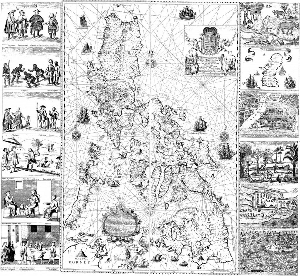
The Murillo Velarde’s map of the Philippine archipelago is a landmark in the depiction of the islands, also known as “Carta Hydrographica y Chorographica de las Yslas Filipinas” of the year 1734.
Who is Murillo Velarde?
Pedro Murillo Velarde was born August 6, 1696, at Villa Laujar, Granada, and entered the Jesuit novitiate at the age of 22. He became a University of Manila professor and rector at Antipolo, a visitor to the Mindanao missions, and procurator at Rome and Madrid. One of his principal publications was Historia De La Provincia De Philipinas De La Compania De Jesus (Manila, 1749), Geographica Historia (Madrid, 1752), in ten volumes. In the Historia, his noted map of the Philippine islands, the first detailed map of the archipelago, was located. It was made by order of the governor of the island, Valdes Tamon, in 1734.
Only 14 copies of the Murillo Velarde map are known to exist in the world. They are in the Philippines, one is previously owned by Ferdinand Marcos and two are in private collections. By 2014, the last one fetched nearly P13 million and went auction in London, taken home by Filipino tech entrepreneur Mel Velarde.
Mercator, Hondius 1619, “Insulae Indiae Orientalis”
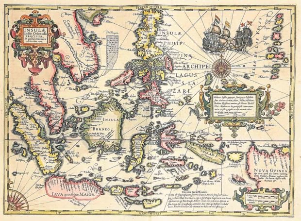
The map’s showcases European knowledge of the East Indies, an area of increasing land exploration of Europe from the early 16th century. It covers from the Philippines to Timor and Sumatra to New Guinea. One of the Jodocus Hondius the Elder (1563-1612) most successful commercial ventures was the reprinting of Mercator’s atlas, where this map appeared. Gerard Mercator died in 1594 and the younger Mercators sold the plates to Hondius in 1604.
Final State of the Gastaldi’s Wall Map of East Asia — The First Great Wall Map of East Asia
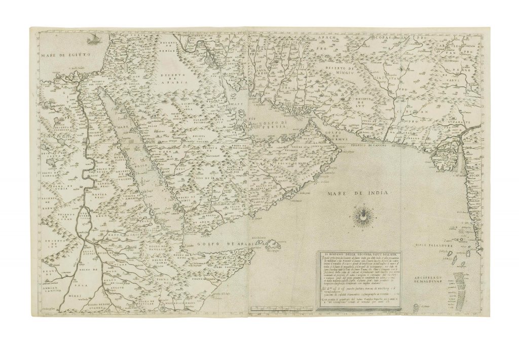
Giacomo Gastaldi’s rare 4-sheet wall map of Southeast Asia, China, and India, considered as the most influential map published in the 16th century. The map has a remarkable history, it represented Italian mapmaking in the mid-16th century. On the right side of the map, we find a list of 100 places on the map, showing ancient and modern names.
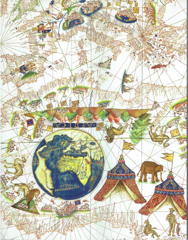
Maggiolo Portolan of 1531
One of the most expensive individual map ever sold in the world is a 6-feet long (original size) reproduction in full color. This is part of Ayala Museum’s Once-In-A-Lifetime Rare Philippine Map Exhibition in October 2018. This “portolan planisphere” map of the world illustrated the first depiction of the eastern seaboard and therefore New York harbor.
This map collection is remarkable and historical, and many are to discover and treasure. Any thoughts? Comment below.


cuanto cuesta cialis en peru cialis viagra cialis generika online deutschland